Data visualization

Data visualization

Data visualization

We visualize the processed data depending on the type of product, so that it is fully legible for our recipients. Below we present examples of the results of analyzes for an advertising project. The first of them - a classified 3D point cloud on which outdoor advertising is detected. The next part presents maps showing the types of outdoor advertising in the indicated area, along with information on the intensity of advertising in terms of the number and validation of the advertisements with the requirements of the Landscape Resolution.

Sample products of processed data

Classified 3D point cloud

Result maps of the conducted spatial analyzes - Inventory of outdoor advertising in public space

The intensity of outdoor advertising by number
Types of outdoor advertising
Validation of outdoor advertising with the requirements of the Landscape Resolution
Validation of small architecture objects and fences

Infrastructure and space management system

We provide data and information on-line, in the SmartGEM system, which uses the potential of cloud computing, comprehensively supporting our clients' business processes.

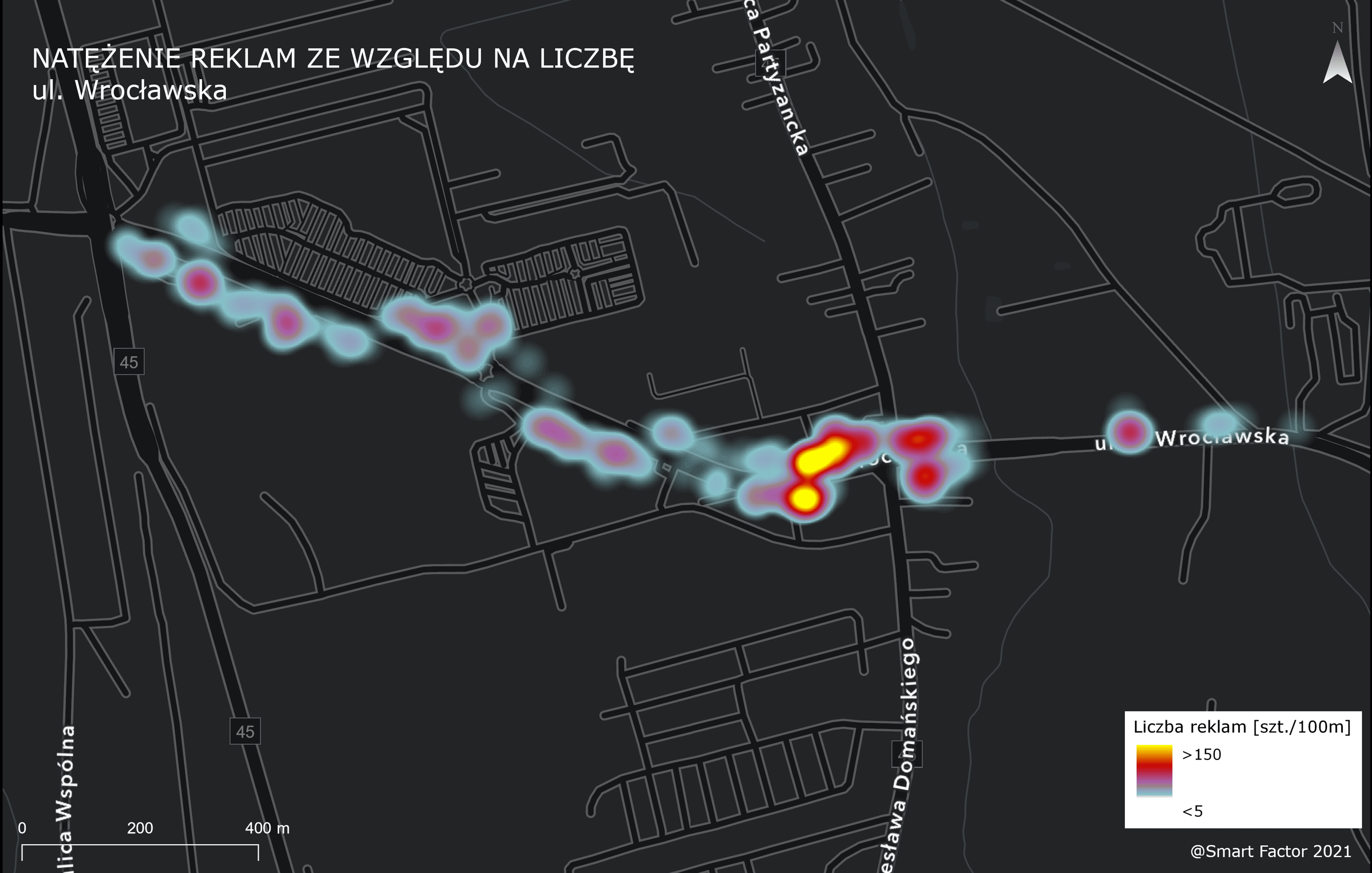
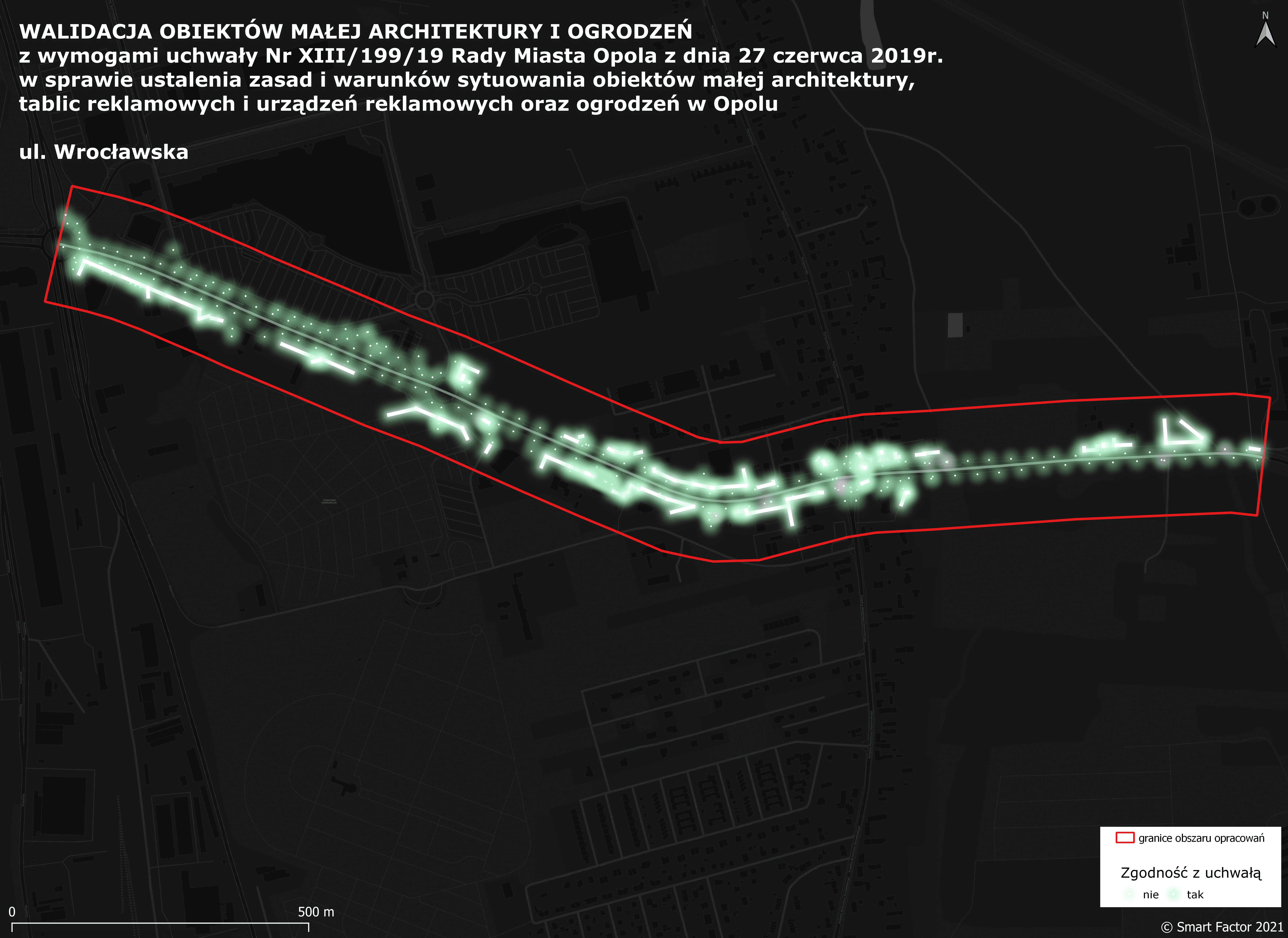
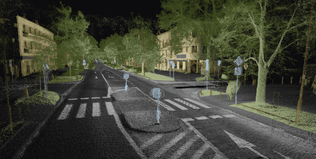
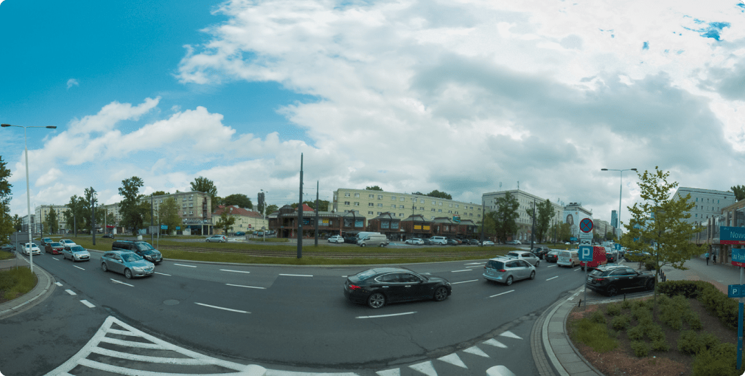
We provide the data we collect to our clients in the form of a vector, road imagery and classified 3D point cloud. Using the appropriate tools, the system user is able to analyze the materials on a 2D map, by viewing photos in a 360-degree panorama or using a browser in 3D space. Depending on the selected variant, it is possible to measure the distance, height, enable additional layers, as well as move in relation to the starting point, with the constant data preview in the form of road imagery or a 3D point cloud.

An example of GIS vector data
An example of data in the form of a 3D point cloud
An example of data in the form of road imagery

Contact

Contact us

    Our branches

    We provide services throughout Poland

    Warsaw office:
    ul. Poselska 29
    03-931 Warszawa

    Elbląg office:
    Aleja Armii Krajowej
    7-8; lok. 31
    82-300 Elbląg

    Write to us
    mail@smartfactor.pl
    Whenever you need to
    Hotline
    +48 573 984 277
    Mon-Fri 9:00 - 16:00
    We meet the needs of modern cities, supporting them in their digital transformation into smart cities. By making a detailed inventory of urban space, in particular the so-called of the road lane, we obtain valuable data for local government and commercial clients, improving the management and maintenance processes of entities subordinate to them. 

    Smart Factor Sp. z o.o. ,
    ul. Poselska 29, 03-931 Warszawa
    NIP: 522-308-82-99 / REGON 366984323

    Entered in the Register of Entrepreneurs of the National Court Register kept by the District Court for the capital city of st. Warsaw, 14th Commercial Division, under the number KRS 0000672154, with a paid-up share capital of PLN 102,000

    Office - tel. 573 984 277
    Sales department - tel. 798 622 487

    mail@smartfactor.pl
    sprzedaz@smartfactor.pl

    Zintegrowany, automatyczny system inteligentnej inwentaryzacji oraz e-kontroli reklam w przestrzeni publicznej, wykorzystujący dane LIDARowe i obrazowe z mobilnych systemów mapowania oraz metody sztucznej inteligencji. Projekt współfinansowany ze środków Europejskiego Funduszu Rozwoju Regionalnego, w ramach Programu Operacyjnego Inteligentny Rozwój 2014-2020. Projekt realizowany w ramach Konkursu Narodowego Centrum Badań i Rozwoju: 1/1.1.1./2020 Szybka Ścieżka.
    Made by
    crossmenu linkedin facebook pinterest youtube rss twitter instagram facebook-blank rss-blank linkedin-blank pinterest youtube twitter instagram